The civil parish of Bainbridge is a sparsely populated upland area of Upper Wensleydale. It lies to the south of the River Ure and is of 60 sq km. The nearest town is Leyburn, 13 miles to the east along the A684. The whole of the parish lies within the boundaries of the Yorkshire Dales National Park and it’s administrative district is Richmondshire.
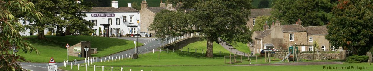
The principal village is Bainbridge, a Conservation Area situated on a limestone terrace above the rivers Bain and Ure. There is a well documented Romano-British fort of AD 100 overlooking the village, which itself dates from the early middle ages when it was a settlement of foresters looking after the hunting forest of Wensleydale. There is a large village green, the property of the Lords of the Manor of Bainbridge, trustees for the parish residents. Medieval ‘strip farming’ fields surround the village.
Views of Bainbridge


A mile east of Bainbridge lies the farming hamlet of Worton, mentioned in the Domesday Book. It was a leadmining centre in the 19th Century.
Countersett is a small hamlet two miles south of Bainbridge, overlooking the glacial lake of Semerwater. The hamlet has a long religious history of non-conformity, with a very early Quaker Meeting House in use to this day.
Marsett is a small farming village a further two miles south. The farms are situated around the village green, exploiting the fields of the flat valley bottom before it rises steeply into the upland areas where there is now much commercial forestry.
Stalling Busk is a small farming community of Norse origin, clinging to the hillside above Semerwater. Although in itself old, there are extensive remains of very old settlements close to the village, principally Iron and Bronze age with some now identified as being as old as Mesolithic. A preserved ruined chapel dates from 1603.

Map showing Bainbridge Parish Council boundaries